Ice storms and blizzards pummel the central U.S. a day after Christmas

MINNEAPOLIS — From an ice storm in North Dakota that sealed windows shut to blizzard conditions in Colorado causing hundreds of airport delays and cancellations, a winter storm pummeled much of the central United States on Tuesday, the day after Christmas.
“The heavy snow conditions in the Plains should be slowly alleviating today (Tuesday), but it’ll be very slow,” said Weather Prediction Center forecaster David Roth. “Even when the snow ends, the high winds should keep visibility near zero — whiteout conditions — for a decent part of today.”
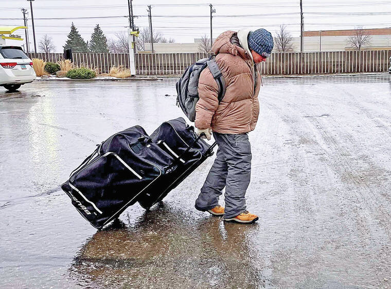
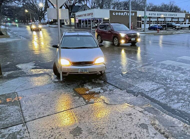
Laura Schmidt-Dockter, a resident of Bismarck, North Dakota, wore ice spikes on her shoes as she walked outside to the trash can. Her driveway was sheer ice, she said. A neighbor took to the street on ice skates.
“It’s actually not bad!” the neighbor quipped about the quality of the ice, skating by Schmidt-Dockter in a video she posted to social media.
At Denver International Airport there were over 530 flight delays and 23 cancellations as of Tuesday afternoon, according to tracking website FlightAware. Blizzard conditions on Colorado’s plains closed Interstate 70 eastbound from the outer edge of the Denver area to Kansas. Travelers were also unable to head westbound into Colorado from Kansas on the highway because of the threat posed by high winds.
According to the National Weather Service, it’s considered a blizzard when winds exceed 35 miles per hour for three hours or more, with considerable blowing snow and visibility down to less than a quarter-mile.
Blizzard warnings were in effect mid-Tuesday for western portions of South Dakota, Nebraska and Kansas, along with eastern portions of Colorado and Wyoming. Ice storm warnings and winter weather advisories remained in place in South Dakota, North Dakota and northwestern Minnesota.
On Christmas Day, one person was killed and three others were injured in Kansas, when the driver of a pickup truck lost control on snow and ice and collided head-on with a sport utility vehicle 5 miles west of Larned, according to the State Patrol. The woman killed in the crash was identified as Evelyn Reece, 86, of Wichita.
Rosebud Sioux Tribe officials in South Dakota said on social media that some people had ignored a no-travel advisory issued Monday evening. The advisory meant no one should have been on highways or backroads because of the whiteout, they said.
“We have multiple resources being dispatched to rescue a total of 13 people who ignored the advisory, and then rescue the ranchers who got stuck trying to get to them,” the tribe’s Office of Emergency Management posted on Facebook early Tuesday. Nine hours later, the office gave an update saying the motorists were safe “and all is well.”
Badlands National Park and the Minuteman Missile National Historic Site in South Dakota were closed Tuesday due to the severe weather.
On Monday, wind gusts howled as high as 67 miles per hour in Oakes, North Dakota, said National Weather Service Meteorologist Megan Jones.
The ice storm has affected highways throughout the eastern parts of the state, with Interstate 29 from Grand Forks to the Canadian border closed until Tuesday afternoon, and no travel advised in south-central parts of the state. Freezing rain began in Fargo on Monday afternoon and expanded westward, Jones said, and as much as three-quarters of an inch of freezing rain fell in Jamestown.
Heavy icing and strong winds downed tree branches and cause power outages in the southern James River Valley.
No major outages were reported. Still, the weather service reminded people about the risk of fire caused by candles or space heaters. Anyone using a portable generator should keep it outside and at least 20 feet away from doors, windows and garages to avoid carbon monoxide poisoning.
“We just want people to be careful if they have power outages,” Jones said. “You always want to be careful with your heat sources.”
•••
Associated Press writers Heather Hollingsworth in Mission, Kansas, and Jack Dura in Bismarck, North Dakota, contributed to this report. Trisha Ahmed is a corps member for the Associated Press-Report for America Statehouse News Initiative.