Winds expected to drive next wave of deadly California fires
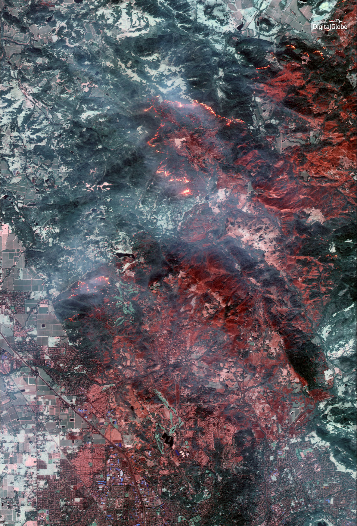
This Tuesday, Oct. 10, 2017, satellite image using shortwave infrared (SWIR) provided by DigitalGlobe shows damage from the wildfire near Santa Rosa, Calif. SWIR imagery allows for the ability to see though smoke to identify active fires, top. Wildfires whipped

0 Comments