LIHUE — The hurricane season is only about halfway over but it has already had so many named storms that it is on track to tie the number generated in 1992 – the year of Iniki. Following on the heels
LIHUE — The hurricane season is only about halfway over but it has already had so many named storms that it is on track to tie the number generated in 1992 – the year of Iniki.
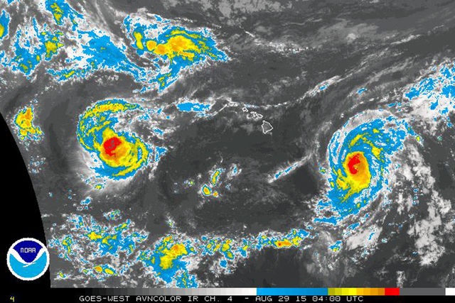
Following on the heels of Kilo — the chaotic cyclone system that could not decide if it was a tropical depression or tropical storm — is Hurricane Ignacio making its way toward the Hawaiian Islands, and Hurricane Jimena is behind that.
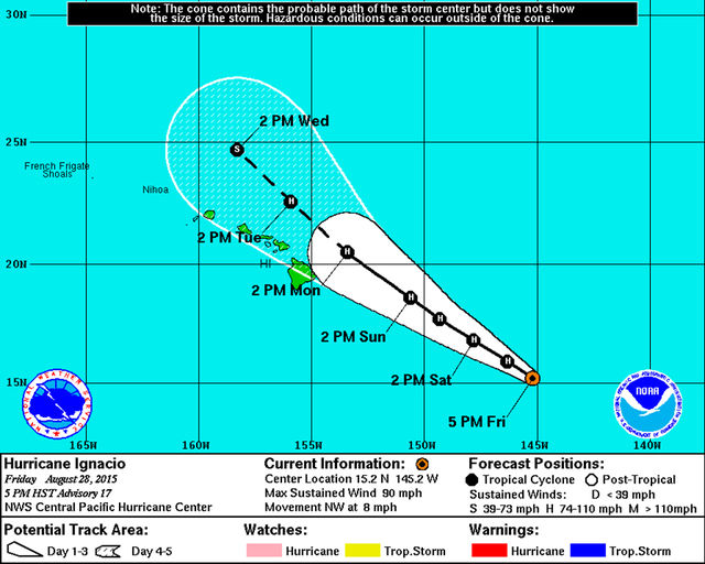
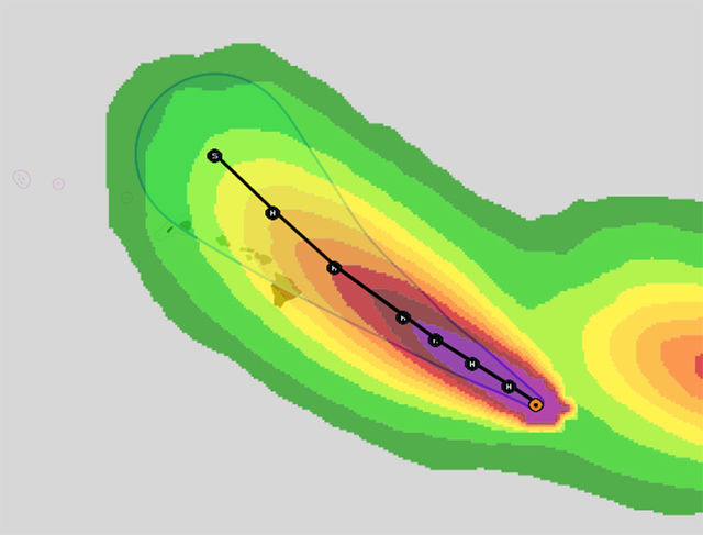
Meteorologist John Bravender, of the National Weather Service’s Central Pacific Hurricane Center, said that the outlook for Kauai is positive, even though Ignacio is currently a strong Category 1 hurricane that is expected to intensify over the next 36-48 hours. The cyclone is expected to then weaken and it should move on a path that will take it to the northeast of the island. But he said there is still reason for concern because Kauai is within the forecasted cone of uncertainty and the system could move inland.
“With the hurricane approaching the area, people should definitely pay attention,” Bravender said. “It’s definitely a threat to take serious.”
Ignacio is more than 1,000 miles east-southeast of Lihue, so there is still a lot of room for error in the path prediction. A more northerly track will likely bring light winds, humid conditions, localized heavy rains, and high surf on east-facing shores. If the track is closer to the island, then there could be stronger, damaging winds and widespread heavy rains and flooding.
This has been an active hurricane season. Ignacio is the 14th named storm. The record for most named storms in the Central Pacific region was 28, which was set in 1992. On average, there are 16.6 named storms during a season, putting this year’s activity level well above average.
But despite the frequency of named storms this year, historically very few actually make landfall.
According to the Central Pacific Hurricane Center (CPHC), from 1949 to 2014, only two hurricanes and two tropical storms made a direct hit on one of the main Hawaiian Islands.
But just because a direct hit from a hurricane is unlikely, the CPHC said residents and visitors should still be prepared: passing storms can still cause dangerous conditions such as flash flooding due to heavy rain, as was seen with Kilo.
On Friday, Gov. Ige signed a pre-emptive emergency proclamation in anticipation of the arrival of Hurricane Ignacio. By signing the proclamation, the governor activated the Major Disaster Fund set aside by the Legislature to provide needed assistance. The proclamation also allows easier access to emergency resources at the state and federal level, along with the ability to suspend certain laws as needed for emergency purposes.
State officials urged the public to not get complacent.
“We understand the public is fatigued from experiencing four major approaching storms so far this season, but we urge people to take the weekend to prepare their homes and families for impacts which could be felt statewide,” said Doug Mayne, administrator of the Hawaii Emergency Management Agency in a press release.
On Kauai, residents said they are ready.
“We don’t want it to come, but if it does, we’re ready,” said Marlena Bunao. “I’ve got far more water than we normally have.”
Jewel Asai expressed a similar thought: “I’m hoping the storm doesn’t come. But if it does come, we’ve gotten our supplies from the other storms.”
Following behind Ignacio is Hurricane Jimena, which as of 5 p.m. Friday already had wind speeds of 125 mph, making it a high Category 3 hurricane, and it is expected to further strengthen as it moves over warm water.
However, Jimena is still more than 2,400 miles away in the east Pacific near to Mexico and will not cross into the Central Pacific for several more days, Bravender said.