WAILUA — County officials said Friday they will begin construction in January of the county multi-use path by Wailua Beach. “I want to acknowledge everyone that met with us over the years and expressed their feelings and concerns about the
WAILUA — County officials said Friday they will begin construction in January of the county multi-use path by Wailua Beach.
“I want to acknowledge everyone that met with us over the years and expressed their feelings and concerns about the path alignment along Wailua Beach,” Mayor Bernard Carvalho Jr. says in a press release Friday.
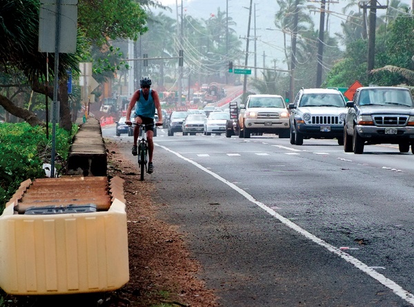
Current plans place removable 10-foot concrete sections of the path on the shoulder of Kuhio Highway, with a portion of each concrete slab over the sand at Wailua Beach, which caused a community outcry at a Kaua‘i County Council meeting Nov. 28.
Before finalizing plans for the Wailua portion of the Ke Ala Hele Makalae, or “the path that goes by the coast,” county officials had many discussions with experts and with the community, according to the release.
The county consulted with Native Hawaiian leaders, representatives of state and federal agencies, experts in coastal land use and cultural archaeology, and a broad cross-section of the community, the release states. A number of technical and cultural studies were also conducted.
“We took what was said and weighed it heavily into our decision-making as we have always considered the preservation and protection of the Hawaiian host culture of utmost importance,” Carvalho says in the release.
In January, construction of the Wailua Beach portion of the path from Papaloa Road to Kuamo‘o Road is slated to begin. The project is expected to last a little more than three months. Upon completion, it will connect to the Lydgate segment at the intersection of Kuhio Highway and Kuamo‘o Road, and the section along Papaloa Road, behind Kinipopo Shopping Village, according to county officials.
Traffic will be impacted by this large-scale project as the highway along Wailua Beach will be periodically reduced from three to two lanes during construction, the release states.
Weather permitting, the construction schedule will be:
• Temporary restriping and installation of safety barriers on Kuhio Highway, from Jan. 2 to 11;
• Installation of the multi-use path, from Jan. 11 to March 29; and
• Permanent restriping of Kuhio Highway, from April 1 to 5.
A major change was made to the path’s original alignment after discussions with the various groups and the technical and cultural studies were completed. The result was a shift from the beach to the right-of-way along the highway, according to the county.
Following the recent erosion event, the design was modified so it can be removed if shoreline erosion threatens its stability in the future. The county will lay down 10-foot concrete sections that can be moved as needed.
County officials said they conducted an archaeological assessment and sub-surface investigation of the project area. The survey was more than what the law requires for federally funded projects under the Section 106 of the National Historic Preservation Act, the release states.
Seventeen backhoe-assisted trenches were dug, exposing modern trash, asphalt, concrete and basalt boulders, but no traditional Hawaiian or historic artifacts, cultural deposits or cultural resources, according to county officials.
Additional work performed by Cultural Surveys confirmed that there are no surface cultural resources, and the results of their ground penetrating radar survey were inconclusive.
In its report, CSH said that the presence of modern debris suggests that any historic or prehistoric deposits that may have been in the project area have likely been removed, displaced or impacted during modern construction, the release states.
Prior to the investigation conducted by Cultural Surveys, the county held a number of community meetings to discuss the possible effects of the path on historic properties as required by Section 106.
Input was provided by several parties, including the Advisory Council on Historic Preservation, state Department of Land and Natural Resources, Friends of Kamalani and Lydgate Park, Halau Kanikapahuolohi‘au, Historic Hawai‘i Foundation, Hui Malama I Na Kupuna o Hawai‘i Nei, county Planning Department; Kaua‘i Heritage Center, Kaua‘i Historic Preservation Review Commission, Kaua‘i Historic Society, Kaua‘i-Ni‘ihau Island Burial Council, Na Kahu Hikinaakala and the Office of Hawaiian Affairs.
Ruby Pap, a coastal land agent with the University of Hawai‘i Sea Grant Program, also provided comment on the path project. She said studies done by UH indicate Wailua Beach has experienced an overall pattern of shoreline accretion, or growth, over the past century at an average annual rate of 0.6 feet per year.
However, she also pointed out that the historical shoreline positions visible on the erosion map indicate that shoreline position is highly variable at Wailua Beach, and the biggest erosion hazard is seasonal or episodic rather than a chronic long-term erosion trend.
On a separate report about erosion in Kapa‘a, Pap says while the data can show past events, it cannot predict the future.
The first segment of Ke Ala Hele Makalae was built nearly 10 years ago at Lydgate Beach Park. The Lihi Park-to-Kealia section was completed in 2008, and the segment between Kealia and Kuna Bay was added in 2010.
Three smaller sections of the multi-use path are currently under way, including Lihi Park to Safeway, Papaloa Road and an offshoot of the main path that extends a half mile from Kuhio Highway up Kawaihau Road to Gore Park.
Phase IV, which will run from Lydgate Park to Ahukini Landing, and Phase VI, from Nawiliwili to Ahukini Landing, are going through the environmental assessment process. After the final EA is completed, the next step will be the special management area and Conservation District Use permitting process.
Planning for Phase V, from Kuna Bay to Anahola, has resumed and a consultant has been contracted for the project.