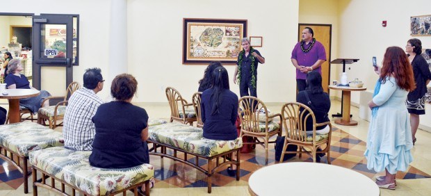
LIHU‘E — Mayor Bernard Carvalho Jr. substituted for the Kaua‘i County Council, which was wrapped up in its weekly meeting Wednesday when Blaise Domino presented the County of Kaua‘i with a historical map print of the island. Carvalho, when asked
LIHU‘E — Mayor Bernard Carvalho Jr. substituted for the Kaua‘i County Council, which was wrapped up in its weekly meeting Wednesday when Blaise Domino presented the County of Kaua‘i with a historical map print of the island.
Carvalho, when asked why the County Council was not present to accept the contribution, said he was able to substitute for the council because the council members were involved in their weekly meeting.
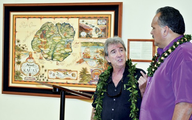
Domino, a cartographic artist based on O‘ahu, creates historical documents interpreting history through research and draws original maps using visual vignettes, states a county release.
One of those vignettes is a rendering of the Hawaiian Island chain with each island marked with the names that existed prior to the arrival of Capt. James Cook.
The early inhabitants who migrated to Kaua‘i between 300 AD and 1200 AD were primarily from Hiva, the Marquesas Islands and later from Tahiti, states Domino’s notes, which are also on display with the historical map in the atrium of the Pi‘ikoi Building.
It is the Marquesans who are thought to be the Menehune, even though they do not have this word, the notes state.
The Tahitian word “Manahune” refers to the lower social status, not diminutive size, and could be a pejorative toward Marquesans.
The elfin myths are a Western contrivance.
Tammi Andersland of the Ship Store Gallery in Kapa‘a, where Domino’s prints are available, explained the original “Atooi” for Kaua‘i was also influenced by Westerners who brought the alphabet to Hawai‘i.
As part of the in-depth look at the island, the print also contains information about historical personalties and events, as well as ecological and cultural issues and items.
“We are grateful for Blaise’s generosity and the personal dedication by this artist,” Carvalho said.
Andersland said the presentation to the County of Kaua‘i follows a similar presentation to the Big Island last July.
She said Domino has completed similar historical maps of Maui and O‘ahu.
“Old maps, to me, represent a quiet authority and grace that, as keepers of information and history, occupy a unique place in art,” Domino said.
“It is my intention to create beauty in this context,” he said.
The public is invited to view the print in the atrium of the Pi‘ikoi Building at the Lihu‘e Civic Center.
More information and other maps can be found by visiting the Ship Store Gallery, which offers historical lectures at 9:30 a.m. on Tuesdays, Wednesdays and Thursdays.
Visit www.blaisedomino.com for more information on Domino’s works.
• Dennis Fujimoto, photographer and staff writer, can be reached at 245-3681 (ext. 253) or dfujimoto@ thegardenisland.com.